
Maryland Heights Street Directory Path
Use the address as a chain of keys, not as proof that every record names the same household. Postal verification first puts the number, street form, unit, city label, and ZIP in a delivery format. The county assessor then links the situs address to a parcel locator and a current property record. From there, GIS supplies the physical parcel context, the Recorder of Deeds supplies the title trail, and a voter request or dated reverse directory can provide a separate address connection when the applicable rules allow it.
- Verify the postal form with USPS ZIP Lookup, including any direction, suffix, or unit that distinguishes the address.
- Run the property address in the St. Louis County Real Estate Search and preserve the displayed locator, situs address, legal description, and owner field.
- Locate that parcel through St. Louis County GIS Online and compare the parcel with the mapped road and adjacent parcels.
- Use the owner, legal description, transfer period, and Recorder document reference to work through the deed chain rather than relying on street text alone.
- For a known person or a dated household question, use the exact voter confirmation route or a properly requested county file, then compare a historical reverse directory for the relevant publication year.
That order keeps a street search grounded in the record each custodian actually maintains. It also makes it easier to note a mismatch instead of forcing postal, parcel, title, and historical-directory data into one claim.
Maryland Heights Address Normalization
A street search can fail because the source and the searcher use different address forms. USPS treats the delivery address and ZIP as a postal question. The assessor, GIS, and city permit records are concerned with a situs or parcel location. A recorded deed uses a legal description that can remain stable even when a street label is abbreviated or a postal label changes. Enter the full practical address first, but retain each source's printed form in notes.
Maryland Heights was incorporated in 1985. Earlier files can identify the area as St. Louis County, a subdivision, a community, or a rural route instead of using the present city name. Major roads such as I-270, Highway 141, Highway 364 or Page Avenue, Dorsett Road, and Westport-area roads help with orientation, but a road name alone does not establish a city boundary or a parcel location.
Note: The assessor help specifically advises using ST rather than Saint where that abbreviation is requested, and common searches can time out until narrowed.
Maryland Heights Assessor Street Fields
The county's Real Estate Search is the most direct Maryland Heights street directory tool for a present parcel connection. It has four modes: Locator Number, Name, Property Address, and Subdivision Name. Results are case-insensitive and open in the right-hand results frame. A property result is still a parcel and tax record. It may show a current owner and a mailing address, but it does not establish who occupies the property.
| Search mode | Field | Verified rule | Useful result |
|---|---|---|---|
| Mode selector | Locator, Name, Property Address, Subdivision Name | Four available modes | Choose the key already known |
| Locator | Locator Number | Required, 4 to 9 characters; nine expected, with two digits, a B-Z third character, then digits | Stable parcel cross-reference |
| Name | Owner or business name | At least 3 characters; last name or organization, with first name following last when appropriate | Candidate parcel records |
| Property Address | Number | Optional numeric field; partial criteria allowed | Narrows a street result |
| Property Address | Direction | Optional; remove it if no result returns | Separates directional streets |
| Property Address | Street Name | Required, at least 3 characters; first character alphanumeric | Situs-linked parcel result |
| Property Address | Suffix | Optional street type | Refines the street form |
| Subdivision | Subdivision Name | Required, at least 4 characters | Group of parcels or a plat lead |
| All modes | Search | Case-insensitive results appear in the right frame | Open a returned row for details |
| All modes | New, Clear, Proper Case, Upper Case, Lower Case | Visible page controls | Reset or normalize a new entry |
Start broadly only when the name is uncommon. For a familiar road or surname, add a street number, direction, suffix, or subdivision. Save the locator exactly as returned. It is more reliable than trying to rebuild a malformed locator from memory.
The assessor search-help screen records the field rules used for the Maryland Heights street directory.
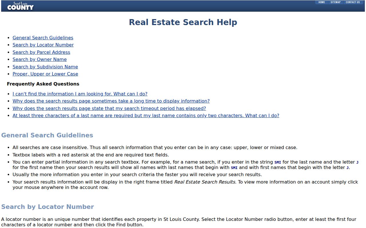
The help screen is most useful before a broad street query, because it shows why a number, suffix, or locator check can turn an incomplete result into a usable parcel lead.
Maryland Heights Permit Street Search
City permit and code information adds a dated municipal activity record to a Maryland Heights street directory. The public Maryland Heights Accela Building portal offers Look Up by Address, Parcel Information, Owner, Record Information, and Licensed Professional. Its address fields are Street Number from, Street Number to, Direction, Street Name, and Street Type. Direction choices include compass forms, while the visible street-type menu begins with common forms such as Ave, Blvd, Cir, Ct, Dr, Expy, Ln, Mdws, Mnr, Pkwy, and Pl.
A street-format miss is a reason to try the parcel or owner mode, not a reason to assume that no city record exists. Public searches can show record summaries, and some documents or services may require login or staff help. Keep the mode, date, terms, and whether the result was a summary, document link, or login prompt with the result.
Maryland Heights Accela's address-search screen shows the city fields used to locate permit and code-record summaries.
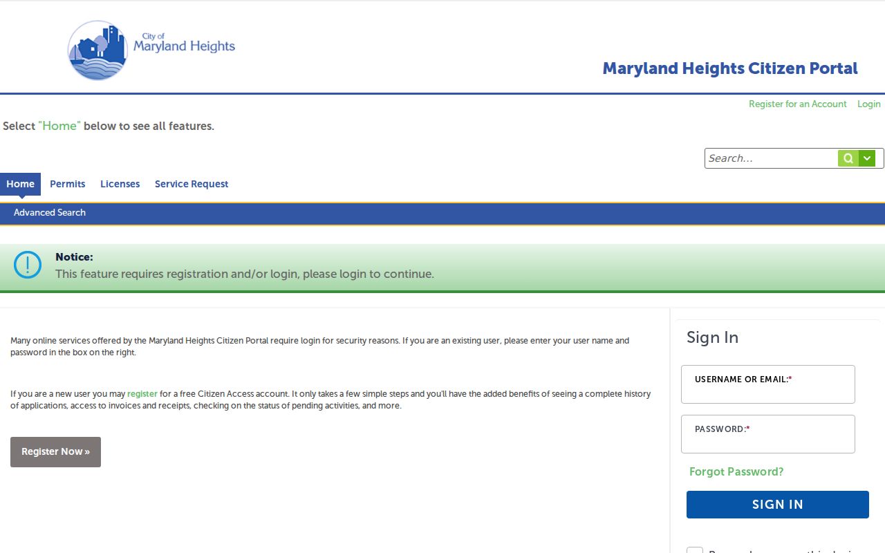
Those fields support an address chronology. They do not turn a permit result into a roster of every person at a street address.
Maryland Heights Street Records Coverage
Each source in an address search describes a different link to the street. Use more than one when a question needs more than a parcel or title answer. The voter web lookup confirms an identified person only, while a full county request is a separate route. The Recorder index provides recorded instruments, and the library's directory materials are dated historical snapshots.
| Source | Address key | What it can show | Best use |
|---|---|---|---|
| USPS | Postal street and ZIP | Delivery geography and address format | Normalize an address |
| Maryland Heights Accela | Number, direction, name, type; parcel or owner alternatives | Permit or code summary and dates | City activity chronology |
| County Assessor | Address, locator, owner, subdivision | Current parcel and tax connection | Start parcel research |
| County GIS | Geometry and locator | Parcel location, adjacent parcels, district context | Check physical context |
| Recorder of Deeds | Parties, legal description, book/page or document number | Recorded title transfer chain | Trace instruments |
| Election records | Known person and permitted address fields | Registration and precinct evidence | Confirm, not casually browse |
| Directories | Address or reverse section, year | Historical address snapshot | Earlier household trail |
The chain is strongest when the locator and legal description agree across parcel and deed records. A current owner field, a voter record, and an old directory entry have different dates and different meanings. Keep each relationship labeled.
Maryland Heights GIS Street Context
The county GIS service makes the street physical. Locate a street segment, select a parcel, record the parcel or locator and the popup fields, then select the parcels on each side and across the road if that comparison matters. The FeatureServer relates parcel boundaries to county ownership, land-use, value, and jurisdictional data. It also supports public spatial queries, although its field names and response limits should be checked in the live service.
GIS can show a parcel relationship even where a street label or postal city does not match the municipality expected by a searcher. Turn on a boundary, zoning, flood, political, school, fire-district, or road layer only when it answers the record question. A map label is context, not a substitute for the deed or parcel card.
Note: County GIS says data are updated as needed, rather than publishing one fixed update interval for every layer.
Maryland Heights Street Deed Chain
Once the assessor has supplied a locator and legal description, move to the St. Louis County deed search. The county describes the online index from 1974. Library materials identify county deed books from 1877 to 1931 and a property-ownership index from 1974 to 1992, so a research trail may need the online index, a copy request, and library material rather than one continuous search surface.
Search the current owner as grantee near the transfer date and compare the legal description to the parcel. Read or order the instrument, then search the seller as the earlier grantee and repeat backward. The Recorder copy-order form accepts property address, owner, approximate purchase date, document type, and a Recorder book/page or document number. Its warning matters: an assessor book/page is not a Recorder citation.
A deed establishes that an instrument was recorded. It does not prove a move-in or move-out date, household composition, or current presence at the address.
Maryland Heights Voter Street Limits
The Missouri voter web lookup is an exact-match confirmation tool. It requires an identified person, full first and last name, date of birth, and county. It is not a street browser. For a permitted broader request, the St. Louis County voter-file form can output street number, street name and type, direction, unit, city, state, ZIP, precinct or split, and selected history fields.
The captured 2025 form lists countywide files at $40, with an additional same-order file at $10, and district or municipal files at $20, with an additional file at $5. It directs requests by email to boecabsentee@stlouiscountymo.gov, fax to 314-615-1998, or mail and in-person delivery at 725 Northwest Plaza Drive, St. Ann, MO 63074. The form carries use restrictions under Missouri law. Confirm the current price and contact route before ordering. Protected addresses and restricted identifiers remain outside a responsible street-level result.
Maryland Heights Street History Clues
Older records can split the trail across St. Louis City and St. Louis County, especially because the city and county became separate governmental entities after the late-1876 separation. For Maryland Heights, the 1985 incorporation is another search switch. A pre-incorporation address may be filed under the county, a subdivision, a community name, or a rural-route label. Preserve the printed address, abbreviations, initials, and year rather than silently converting it to a modern format.
Reverse or criss-cross directories can connect an address to an occupant in the years where the volume includes that section. They are dated evidence, not a present roster. The Maryland Heights city directory collections provide the historical-shelf route for checking the volume and its publication year.
Maryland Heights Street Record Terms
The same house can carry several valid address descriptions. Knowing which one appears in a record avoids a bad match between postal information, property records, and title documents.
- Parcel
- A defined piece of land in the county property system, commonly tied to a locator and mapped boundary.
- Situs address
- The physical property address used by the assessor, GIS, and permit systems. It can differ from an owner's mailing address.
- Plat
- A recorded subdivision map that places lots and blocks. The recorded plat or deed, rather than a map label alone, governs title boundaries.
- Criss-cross directory
- An address-first directory section that may list an occupant or householder for the publication year.
Postal delivery, parcel location, legal description, and a historical directory entry should stay as separate fields in a research note. Their agreement can support a conclusion, but one field should not be substituted for another.
Maryland Heights Street Directory Limits
A street directory can identify public property, title, municipal, voter-request, or dated-directory records, but it cannot establish every resident at a home. An assessor owner is not necessarily an occupant. A tax mailing address may be elsewhere. A postal ZIP confirms delivery geography, not identity. Utility customer lists are not a general public people index, and protected voter addresses, Safe at Home participants, and restricted court material require care.
When a record is needed from a city custodian, ask the Maryland Heights city department directory for the records path and request a defined series with the address, date range, and record type. Missouri Sunshine Law Chapter 610 requires a response no later than the end of the third business day, subject to an explanation of any delay, and permits charges under section 610.026. A focused request for a permit, board record, or dated city file is clearer than a demand for everything connected to a street.
Lawful use. Use Maryland Heights address records for lawful personal research, civic questions, or family history. Do not use a street result to stalk, harass, or harm anyone.